Land Surveyors Services
What is involved in the land surveying process
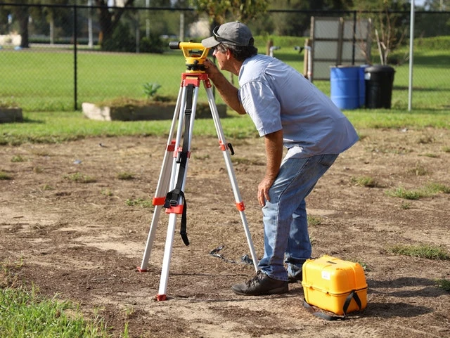
The land surveying process begins with an initial consultation where the surveyor gathers information about the property, including its history, legal descriptions, and any specific concerns or requirements. The surveyor then conducts fieldwork, using specialized equipment to measure the land, locate boundary markers, and record topographical features. This data is analyzed and cross-referenced with existing records, such as deeds, plats, and public land surveys, to ensure accuracy.
The surveyor may also consult with local authorities to verify legal boundaries and address any zoning or regulatory issues. After completing the fieldwork and analysis, the surveyor prepares a detailed report that includes maps, boundary descriptions, and any relevant notes or recommendations. This report is essential for property owners, developers, or legal professionals, providing a clear and accurate representation of the land’s boundaries and features.
What long-term benefits can you expect from a professional land survey?
A professional land survey offers long-term benefits, including clear property boundaries, protection against legal disputes, and support for future development or construction projects. By accurately defining the limits of your property, a survey helps prevent conflicts with neighbors over land use or encroachments. It also provides critical information for planning and zoning, ensuring that any improvements or changes to the land comply with local regulations.
Additionally, a land survey can enhance the value of your property by providing potential buyers or investors with confidence in the accuracy of the land's dimensions and boundaries. Overall, investing in a professional land survey is a wise decision that safeguards your property rights and supports informed decision-making.
FAQ
When should I consider getting a land survey?
You should consider getting a land survey before purchasing property, building a fence or structure near the property line, subdividing land, or resolving boundary disputes. A survey ensures that you have accurate information about the land’s boundaries and features.
What types of land surveys are available?
There are several types of land surveys, including boundary surveys, topographic surveys, construction staking, and subdivision surveys. Each type serves a specific purpose, such as determining property lines, mapping land features, or planning construction projects.
How long does a land survey typically take?
The time required for a land survey depends on the size and complexity of the property, as well as the type of survey being conducted. A standard boundary survey for a residential lot may take a few days, while larger or more complex surveys could take several weeks.
How do I choose the right land surveyor for my project?
To choose the right land surveyor, consider their qualifications, experience, and familiarity with the local area. It’s important to hire a licensed surveyor who is knowledgeable about local land laws and regulations. Checking reviews and asking for references can also help ensure you select a reputable professional.
What should I do with the land survey report once it’s completed?
Once the land survey report is completed, you should keep it in a safe place, as it is an important legal document. The report can be used for legal purposes, property transactions, and future land development. Sharing the report with your lawyer, real estate agent, or contractor can also be helpful.


